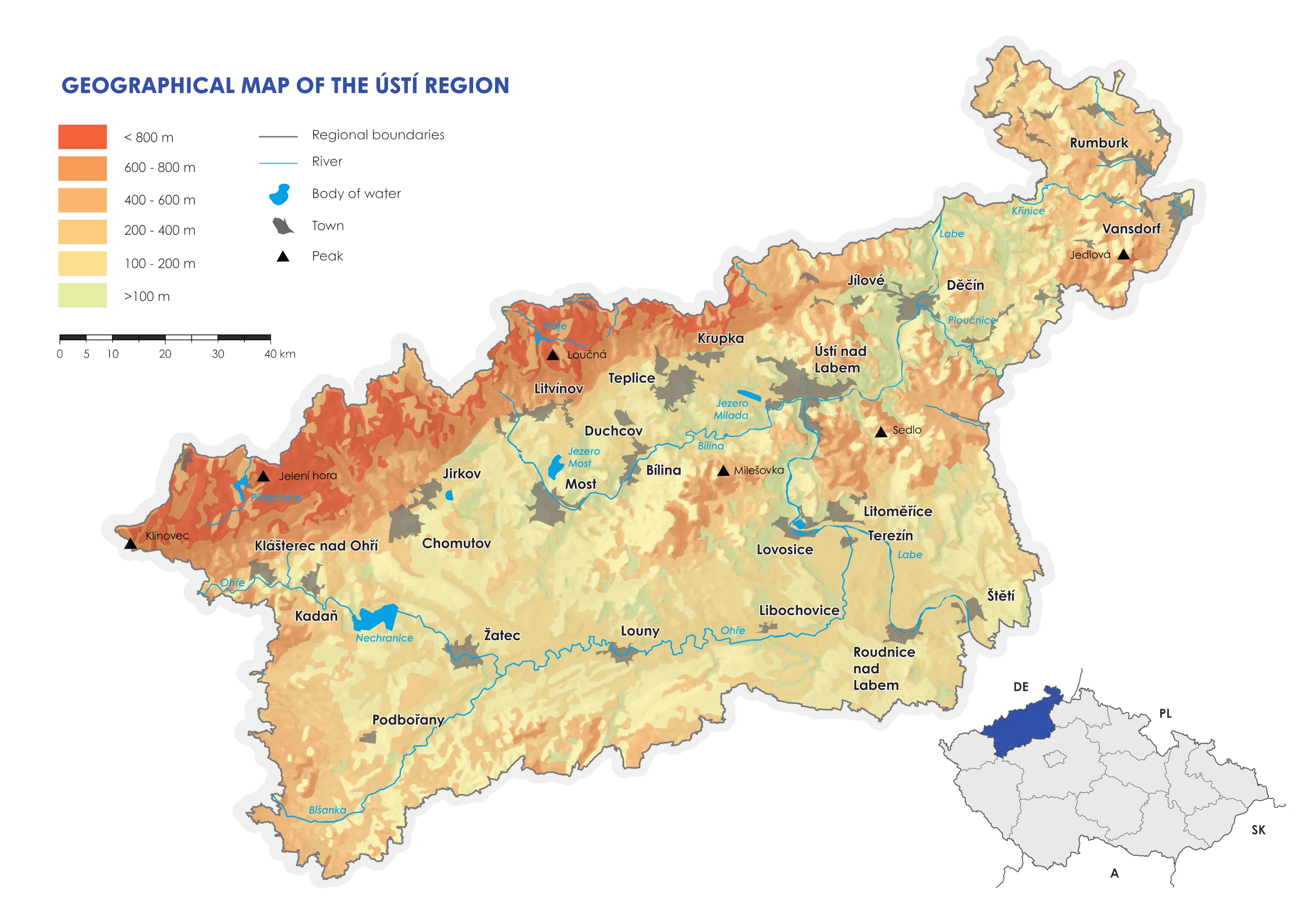
Basic geography
The Ústí nad Labem region is located in the northwest of the Czech Republic. The northwestern border of the region is also the state border with the Federal Republic of Germany, specifically with the Federal State of Saxony. The Ústí nad Labem region is bordered to the northeast by the Liberec region, to the west by the Karlovy Vary region and to a small extent by the Plzeň region, and to the southeast by the Central Bohemian region.
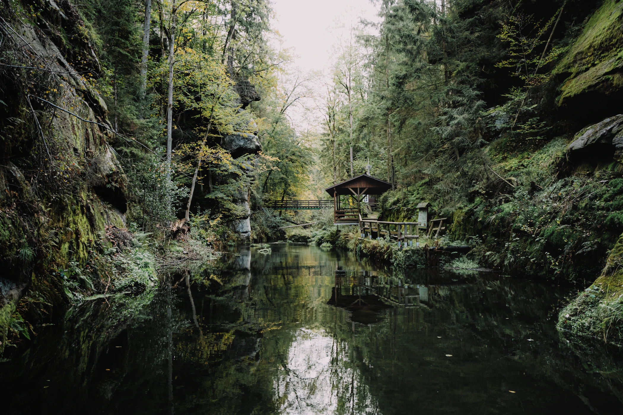
Nature and landscape
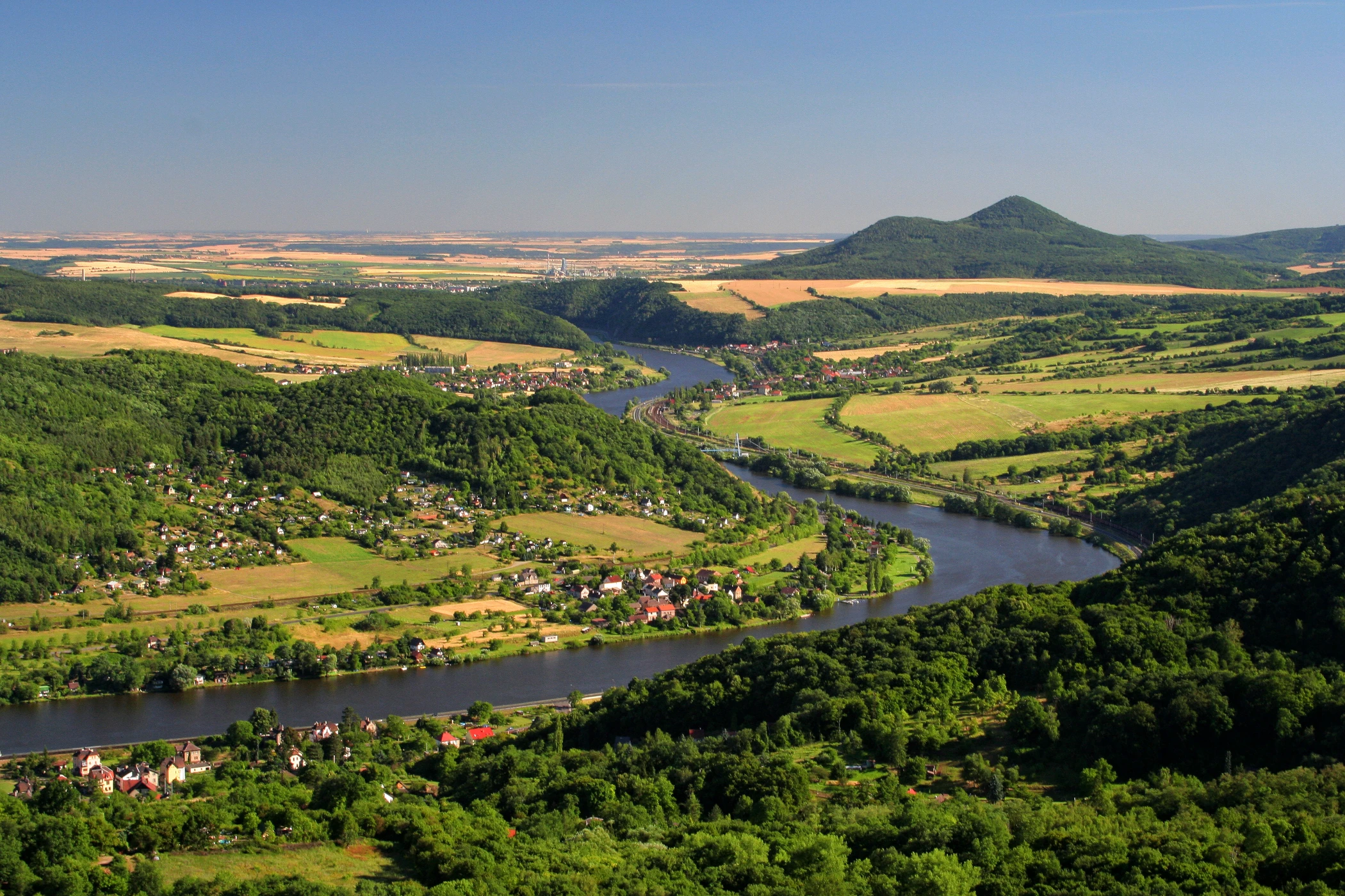
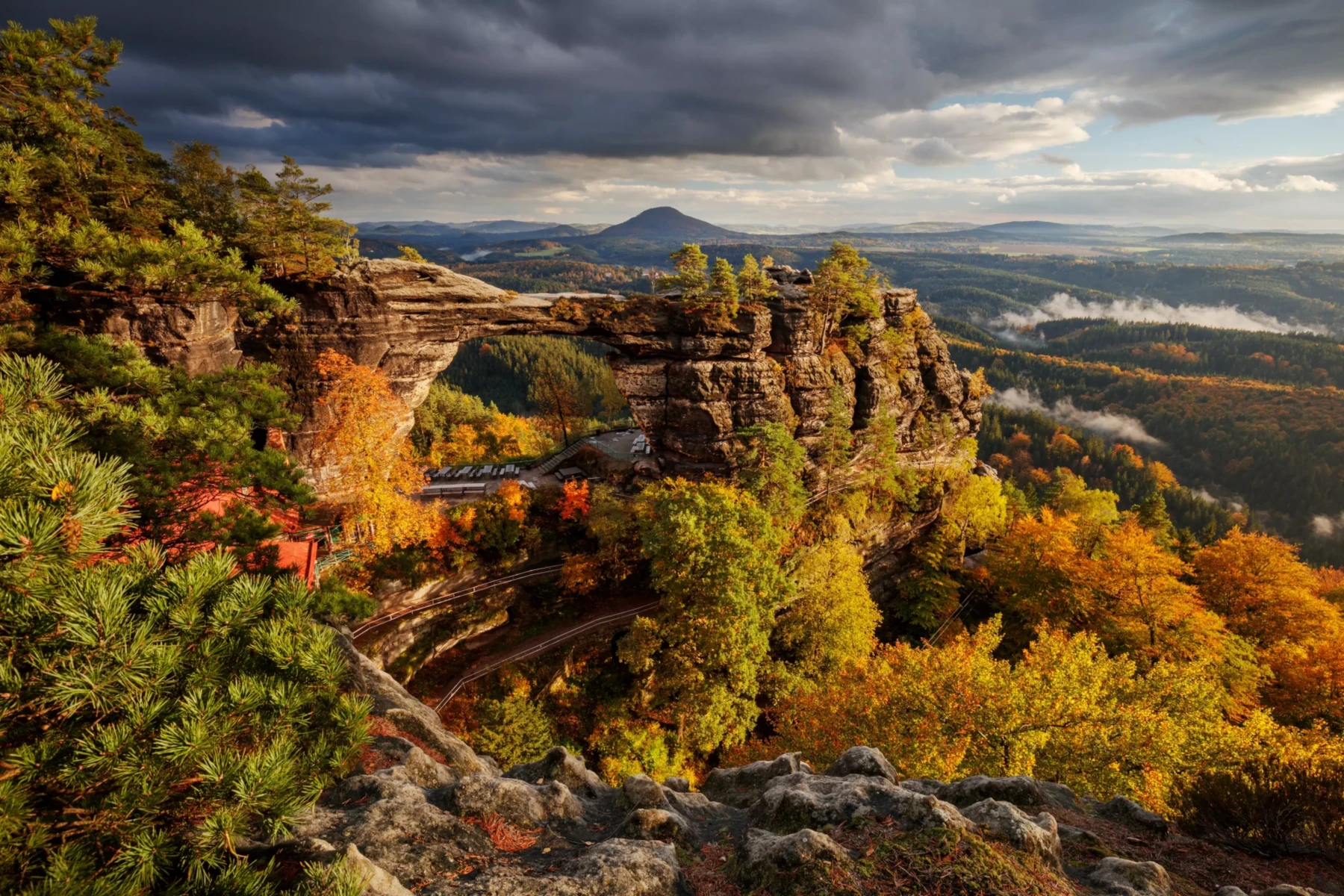
The surface of the region is highly geographically diverse, nature is extremely varied. Along the border with Germany, the region is enclosed by the Ore Mountains, the Elbe Sandstone Mountains and the Lusatian Mountains. The Ore Mountains are a very old mountain range primarily comprised of deep igneous rocks and Palaeozoic crystalline schists. The southeast part of the region has plains dating back to the Mesozoic era, the Bohemian Cretaceous Basin, from which the most historically famous mountain in Bohemia, Říp, and the Czech Central Highlands with its highest peak, Milešovka, stand out. The Bohemian Central Highlands were formed by volcanic activity during the Tertiary period and have a unique landscape character, with many contrasts and picturesque corners. The highest point in the Ústí nad Labem region is located on the border of the Ústí nad Labem and Karlovy Vary regions below Mt. Klínovec at an elevation of 1,231.27 m above sea level. If we ignore the bottoms of surface mines, the lowest point of the region is the surface of the Elbe River near Hřensko (115 m above sea level), which is also the lowest point in the Czech Republic. The largest watercourse in the region is the Elbe River, into which the second largest left-bank tributary of the Elbe, the Ohře River, and the Bílina River flow. On the right bank, the Ploučnice River flows into the Elbe River in the territory of the region, and the last right-bank tributary in our territory is the Kamenice River. There are also mineral and thermal springs in the region. The largest body of water is the Nechranice Reservoir, built on the Ohře River in the western part of the region.
The total area of the region is 5,339 km2, which represents 6.8 % of the area of the Czech Republic. Agricultural land covers more than 51 % of the territory of the region, forests cover almost 31 % and water areas 2 %.
Key geographical features of the Ústí nad Labem region
The northernmost point
The northernmost point of the Czech Republic is located on the Czech-German state border at border stone No. 2/41 in the cadastral territory of the Severní settlement, part of the northernmost Czech village of Lobendava in the Děčín district.
The lowest point
The lowest natural point in the Czech Republic is the surface of the Elbe River at Hřensko on the Czech-German border, where the Elbe leaves Czech territory, at an elevation of 115 m above sea level.
The windiest place
The windiest place
The top of Milešovka is the windiest place in the Czech Republic. The average wind speed throughout the year is 30.6 km/h. It is also the stormiest place in the Czech Republic, as storms are recorded on an average of 31 days a year.
The driest place
The driest place in the Czech Republic has long been the village of Libědice in the Chomutov district. The average annual rainfall here is only 410 mm, while the average annual rainfall in the whole country is 600-800 mm. The area lies in the rain shadow of the Ore Mountains.
The warmest place
The village of Žitenice in the Litoměřice district is described as one of the warmest places in Bohemia. The average annual temperature here is 9.42 °C, which is well above the national average.
The strongest river flow
The Elbe River near Hřensko is the river with the highest flow rate in the Czech Republic. The average flow rate is 308 m3/s.
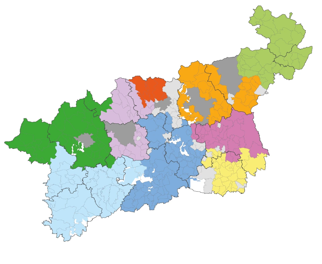
The division of the region
Ústí nad Labem region consists of seven districts. The largest district in terms of area is the Louny district (1,121 km2), while the smallest district is the Ústí nad Labem district (405 km2). The districts of Litoměřice and Louny have a more rural character. This is also confirmed by comparing the number of municipalities: 105 and 70 in the Litoměřice and Louny districts compared to only 26 and 23 in the Ústí nad Labem and Most districts.
The territory of the region is further divided into administrative districts of 16 municipalities with extended powers.
There are a total of 354 municipalities in the Ústí nad Labem region. The largest size category is small municipalities. There are 169 municipalities with up to 500 inhabitants in the region, and another 87 municipalities with 500-1,000 inhabitants; in total, these two categories represent nearly three-quarters of the municipalities in the region. On the other hand, only three towns (Ústí nad Labem, Most and Teplice) have more than 50,000 inhabitants.
The Development Strategy of the Ústí nad Labem region until 2027 divides the territory of the Region into five types of regions:
- Core region: the territory of the Ústí nad Labem district and the southwestern part of the Děčín district.
- Basin region: the territory of most of the districts of Teplice, Most and Chomutov under the Ore Mountains.
- Recreational areas: the Ore Mountains, the Elbe Sandstone Mountains, the Lusatian Mountains.
- Ohře River region: mainly lowland and agricultural area of the districts of Litoměřice and Louny.
- Šluknov region: northern part of the Děčín district
Nine local action groups operate in the Ústí nad Labem region.
